There is a stretch of ocean in the Pacific that is now hotter than it has ever been measured, and it is changing the weather for the whole planet.
It is called El Niño. Spanish for "the little boy", a name Peruvian fishermen gave it long ago because the warm water usually showed up around Christmas.
Here is what it is.
The Pacific Ocean near the equator, from the middle of the ocean to the coast of South America, warms more than usual. That warm water moves rain, wind and heat around in patterns that reach every continent.
The opposite phase, when the same water runs cooler than normal, is called La Niña. When it is close to normal, forecasters call it neutral.
El Niño comes every two to seven years and lasts about nine to twelve months. It usually starts building between March and June and peaks between November and February.
It is here now, and it is not small.
On 8 October, the United States Climate Prediction Center kept its El Niño advisory in place and said the event "continues to strengthen". Water in the key monitoring area, Niño-3.4, was 2.1 degrees above average. Parts of the eastern Pacific were more than 4 degrees above average.
The World Meteorological Organization said the same day that the October to December average in that region could reach 3.7 degrees above normal, peaking around December. That would be the highest since records began.
The old record was 2.6 degrees, set in the event of 2015 and 2016.
The centre put the chance of this event beating every El Niño since 1950 at 83 per cent for October to December. It also said strong to very strong conditions are likely to hold through January to March 2027.
The head of the WMO, Celeste Saulo, did not soften it. "El Niño is firmly established and strengthening rapidly," she said.
What it does.
El Niño does not send one storm to one country. It loads the dice. It makes some places wetter, some drier, and almost everywhere hotter, and then the weather rolls as it rolls.
The WMO says above-average temperatures are likely over nearly every part of the globe in this period. It is a shift in the odds, not a promise, which is why forecasters speak in percentages.
For Nigeria, that shift has four faces. Rain, heat, water and money.
Start with rain, because that is the one NiMet has already mapped.
In its August update, the Nigerian Meteorological Agency said this El Niño would likely bring normal to above-normal rain to much of the north, including Sokoto, Kebbi, Zamfara, Katsina, Kano, Yobe, Borno, Bauchi and Jigawa.
It warned of drier than normal conditions across the south, particularly Lagos, Ogun, Oyo, Osun, Ekiti, Edo and Delta, with Kogi and parts of Benue also expected to see less rain.
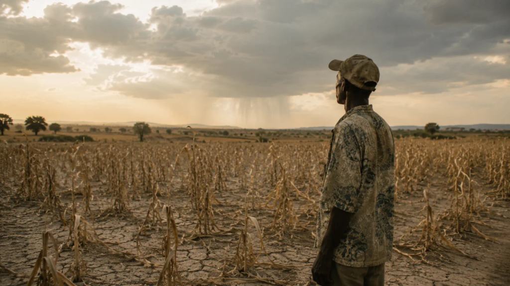
Fewer rainy days, however, does not mean gentler weather. Climate scientists working on the Nigerian picture expect longer dry spells in between, and then short bursts of heavy rain that the ground cannot absorb. That is how a dry season and a flood end up in the same month.
NiMet also warned that the event could shorten the growing season in the north, and that heavier rain in the far north raises the risk of flooding there.
Then there is the heat, and this is where the numbers turn dark.
In September, the African Centre of Meteorological Applications for Development circulated a note to African Union organs. It said the Sahel will face exceptional heat, and it put a figure on it.
A study by the Climate Impact Lab at the University of Chicago projected 66,800 extra heat-related deaths across the Sahel between September and February, compared with a normal year. Nearly half of them, about 31,400, are projected for Nigeria. Sudan follows with 17,500, Niger with 10,000 and Chad with 8,000.
Those are modelled estimates, not a body count, and they assume nothing changes. But they tell you what kind of event this is.
Heat kills quietly, in bedrooms without air, in traffic, on building sites, among people who cannot afford to stop working.
Food is the second bill.
Annual food inflation in Nigeria rose for the sixth month in a row in July, reaching 20.3 per cent. FEWS NET, the famine warning network, expects 21 to 22 million Nigerians to need food assistance through January 2027.
Electricity is the third. The grid leans on hydropower, and hydropower leans on rain.
BMI, the Fitch Solutions research arm, said in June that past El Niño events cut Nigeria's hydropower use by nearly 25 per cent, and warned that a stronger event could take more. It named Nigeria the West African Power Pool market most exposed through imports.
The Association of Nigerian Electricity Distributors has already said the big hydro plants are running below capacity. Less water means less power, higher costs and longer outages, in the same months when homes need fans most.
Then disease.
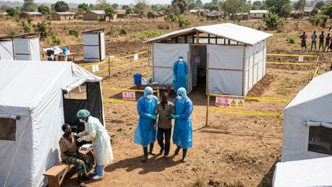
Heat, rain and dirty water are a bad combination, and Nigeria is starting from a weak position.
FEWS NET says the country is carrying the largest cholera outbreak in West and Central Africa, with more than 50,000 cases and 338 deaths since January. Borno has the worst of it.
The warning network said rising rainfall and humidity are lifting the risk of waterborne disease, and NiMet flagged malaria and typhoid as well. Cholera does not need a flood. It needs one bad well.
The floods have their own map. In its 2026 Annual Flood Outlook, the Nigeria Hydrological Services Agency rated 14,118 communities in 266 local government areas across 33 states and the Federal Capital Territory as high risk, out of more than 30,000 flagged.
About 4.2 million hectares of farmland sit in the path, and the risk to farmland peaks in October and November.
Coastal and riverine flooding is expected in Bayelsa, Cross River, Delta, Lagos, Ogun, Rivers and Ondo. Flash and urban flooding is expected in Abuja, Lagos, Port Harcourt, Ibadan, Kano, Kaduna, Enugu, Calabar, Makurdi, Yola and Abeokuta, mostly because the drains cannot take it.
What should you actually do.
Start with water. If you live in the south, treat this as a dry season that arrives early and stays longer than usual. Fix the tank, fill what you can store, and do not wait for a shortage to think about it.
Treat your drinking water, or boil it, from now on.
Buy the tablets, keep them in the kitchen, and use them even when the water looks clear.
Then heat.
The dangerous part of a hot season is the night, because the body does not get to cool down. Keep water by the bed, keep the room as open as you can, and check on older neighbours, babies and anyone who works outdoors.
Keep oral rehydration salts at home, and keep more than one sachet.
Cholera and heat exhaustion both start with the same thirst, and the sachet buys you the time to get to a clinic.
If you live in the north, clear your drainage now, before the heavy weeks.
Do not wait for the flood to find the blocked gutter for you.
Watch food prices rather than panic about them. Less rain in the south and a shorter season in parts of the north both push at grain, tomato and vegetable prices. Buying early and buying dry is cheaper than buying late.
If you farm, NiMet's advice is practical. Choose drought-tolerant or early-maturing varieties where the rain is expected to fail. Do not apply fertiliser into a dry spell, because it will not reach the root and you will lose the money. And speak to your extension officer before you spend.
Charge your power banks and your lamps, and do it while the light is on. Lower dam levels mean less hydropower, and the outages will not wait for a convenient week.
What else to know.
This is a strong event, but not a supernatural one. El Niño does not mean there will be no rain. It means the rain will fall differently, and the dry days will come at the wrong time.
Its effects can lag. Some of the worst damage in an El Niño year lands in the season after the peak, which is why the months to watch are December through March 2027.
Forecasters expect the ocean to start cooling after the peak, with neutral conditions returning by spring or early summer next year.
Climate change does not cause El Niño. The WMO is clear on that. What a warmer world does is load the same event with more energy and more moisture, so the rain is heavier and the heat is hotter than the same El Niño would have been fifty years ago.
And one honest limit.
These are probabilities, not prophecies.
A forecast of a very strong El Niño still leaves room for a quiet week, and a quiet month does not mean the event is not happening.
The Pacific is as hot as it has ever been.
What Nigeria gets from it will be decided over the next six months, one week at a time, and the people who prepare early will pay the least.
Are you interested in learning how to write professionally and earning money as a writer and content creator? Contact Auxi Sherpa today to start your writing journey immediately.
Editorial note: The writer of this article does not claim to know any of the officials quoted personally. The information regarding the forecasts, as published on Global News Arena, is based entirely on independent internet research.
If you have an article, opinion piece, event or news story you would like published, Global News Arena would love to hear from you.